Technology News
EagleView to Provide High-Res Imagery, Analytics for Top 50 Markets
Company touts new ‘coverage and recency standard’ for aerial imagery and insights market

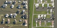
EagleView is a leader in geospatial technology and says it possesses the largest geospatial data and imagery library ever assembled, encompassing 94 percent of the U.S. population.
— Image courtesy of EagleView
EagleView, an aerial insights and corresponding analytics firm, announced it would now provide imagery and enhanced property analytics for the top 50 United States metro areas one or more times per year in addition to its current, customer-driven aerial capture.
In an Oct. 31 news release, the company said that, with more frequent image capture available across top metros, EagleView will continue to be the leading choice for customers seeking a high-resolution, historical library of aerial imagery and property analytic insights.
“Our goal is to make it as easy as possible for customers to get the information they need–when they need it–to make the decisions that matter most,” said Piers Dormeyer, CEO of EagleView. “We want to make sure our customers have the best and most current aerial imagery on the market, and we can deliver that to them.”
EagleView said its imagery, including ultra-high resolution up to 0.75 inches and derivative analytics solutions, continues to expand and improve due to its investment in advanced capture technologies, adding that the benefits will help insurance carriers, governments, large-scale construction companies, mortgage providers and REITs.
“We have listened to customer and partner feedback. This expansion in our capture strategy means we now have the best combination of urban, suburban, and rural coverage on the market,” said Senior Vice President and General Manager of Insurance David Bairstow.
“EagleView is excited to further build upon our more than one billion image database, which provides coverage of property of 94% of the U.S. population, with new areas and more frequent captures,” SVP and General Manager, Imagery, Infrastructure & Emerging Market for EagleView, Patrick Gill, said. “This advancement continues to deliver the high-resolution imagery, data, and analytics our customers need to drive greater success in their operations.”
For more information, visit eagleview.com.
Looking for a reprint of this article?
From high-res PDFs to custom plaques, order your copy today!


